Google Maps Strikes Again
Or: Oops I did it again….
A few years ago I wrote about riding my motorcycle into the jungle of a small Javanese Sultanate by blindly following Google Maps… In theory, that experience should have prepared me for a future of skepticism and hesitancy whenever Google Maps recommends routes, or at least imbued me with the first-hand experience that sometimes its best to turn around when the path becomes more difficult than expected.
In practice, apparently, I am still totally willing to follow Google Maps directly into whatever dangerous situation it recommends. Either I’m a slow learner or too much time passed between lessons, because I made exactly the same mistake again.
After Climbing in Moab for a few days, and visiting the beautiful Arches National Park, the desert had the audacity to rain on us. Sandstone, already soft when dry, has the terrifying ability to liquefy on climbers when wet.
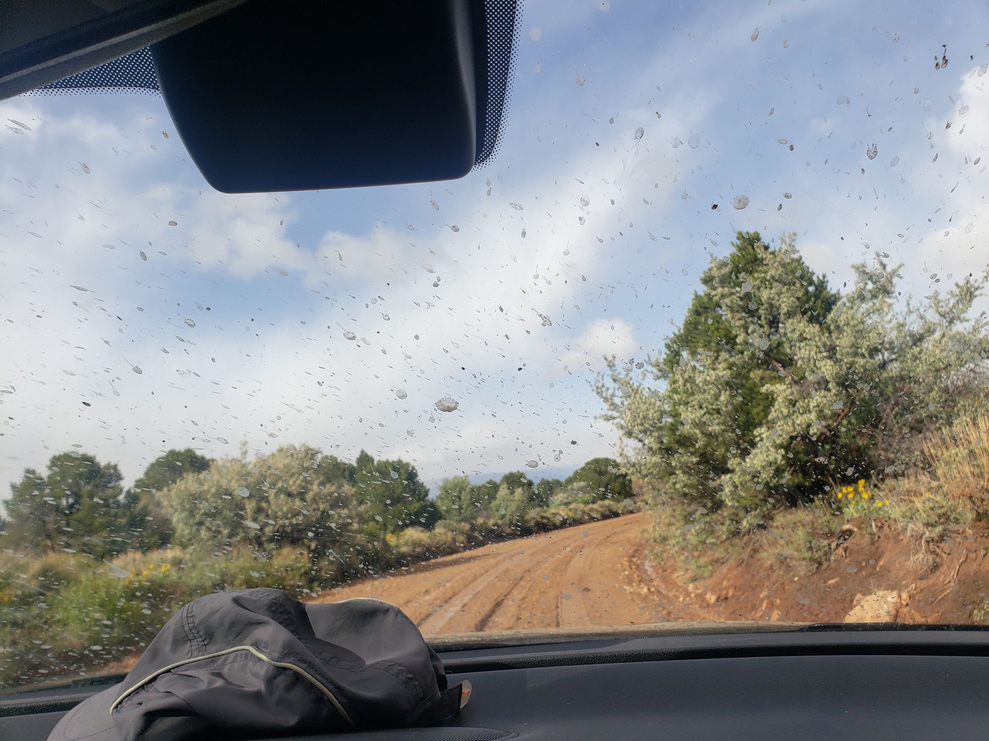
Determined to climb something less deadly, we set out to a granite cliff just over the border from UT in Colorado, Unaweep Canyon. Google Maps had the helpful suggestion to take the most direct route on Dolores Triangle Safari Rte. That name didn’t give us any pause.
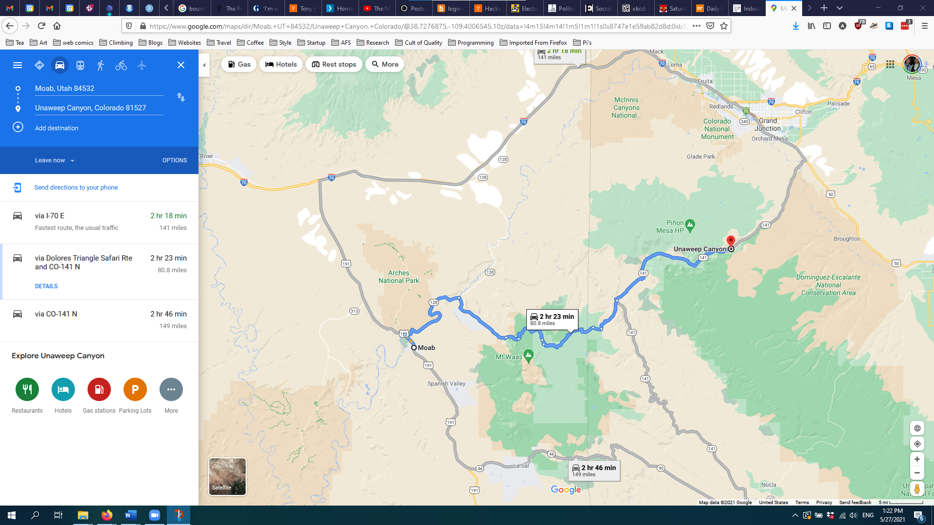
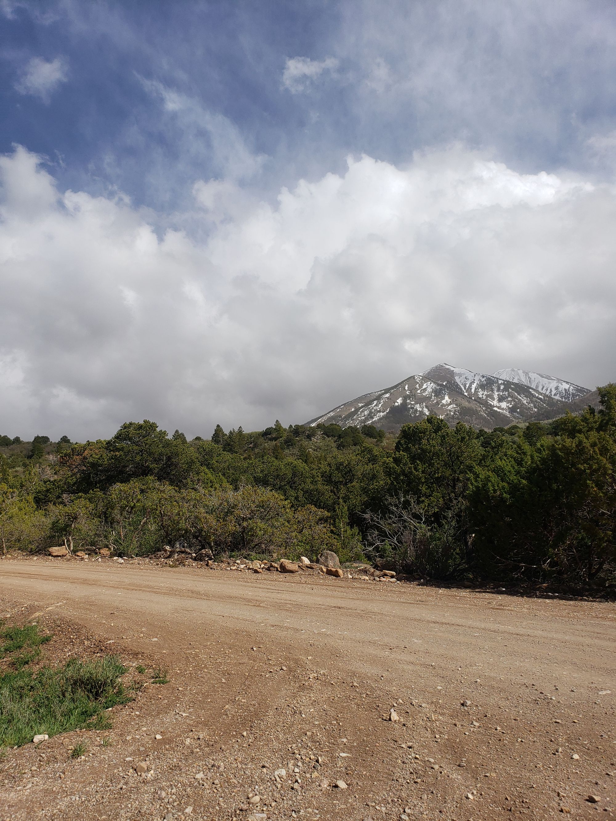
The road climbs the northern steps of Mount Waas in the La Sal mountain range, to a high point of 8,400′ elevation. While the first few miles are mild and paved, the road suddenly turns to dirt.
OK – a few miles of dirt won’t hurt. We briefly considered turning around, but the map showed just a few short miles on this road. Certainly we’ll reach pavement again soon we thought as the dirt turned to mud.
And suddenly I was coaching Nancy on how to oversteer and understeer as we slid downhill, with a shear cliff-face on one side of each switchback. The assumed normal car ride from one climbing area to another turned potentially deadly without any warning. Each switchback I would say “bail left” or “bail right”, so if we lost control of the car, Nancy could try to crash us into the uphill slope instead of plunging off the mountain.
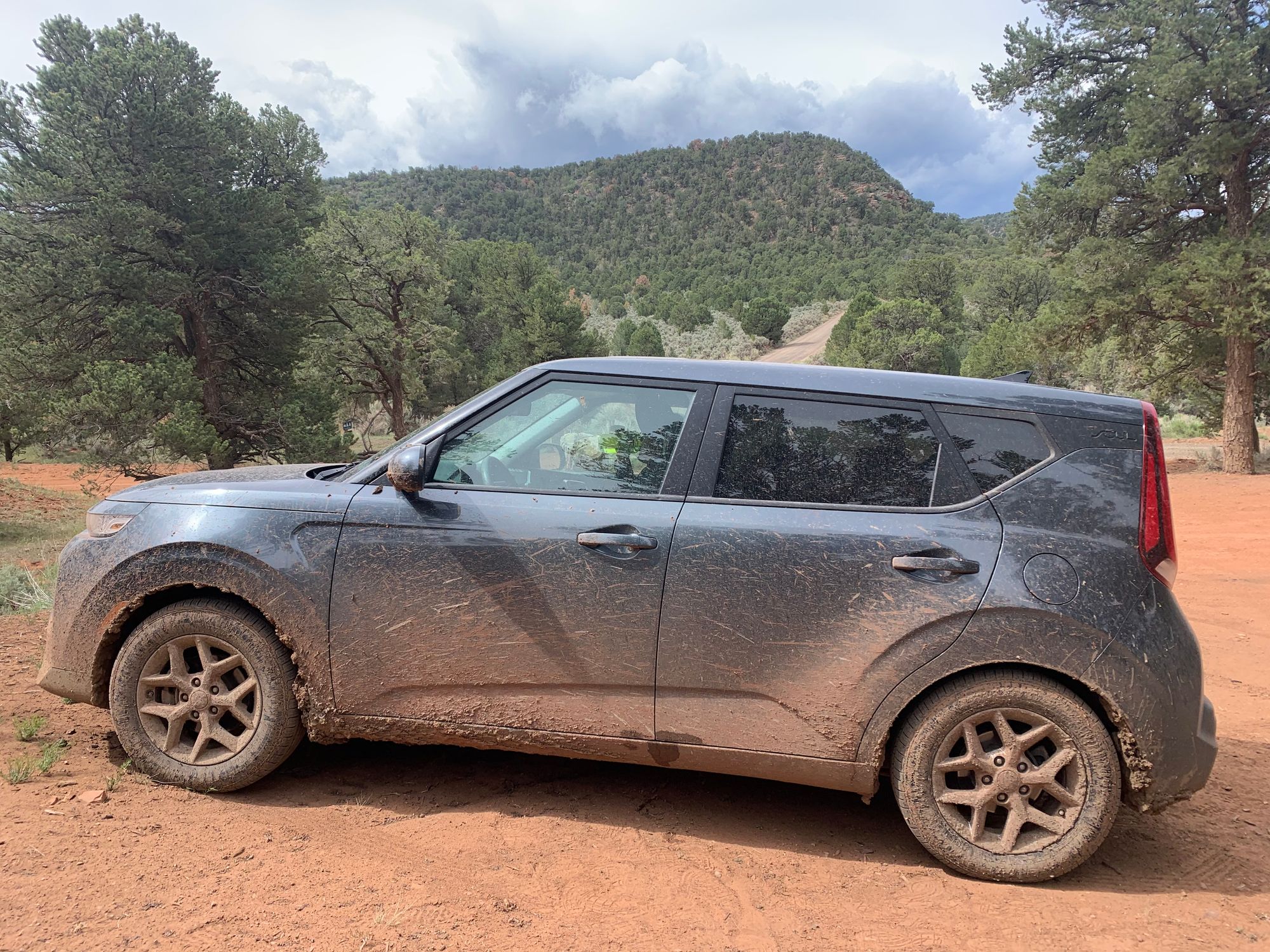
After barely surviving the downhill, we came upon deeper and deeper mud on the flat land, until we got stuck.
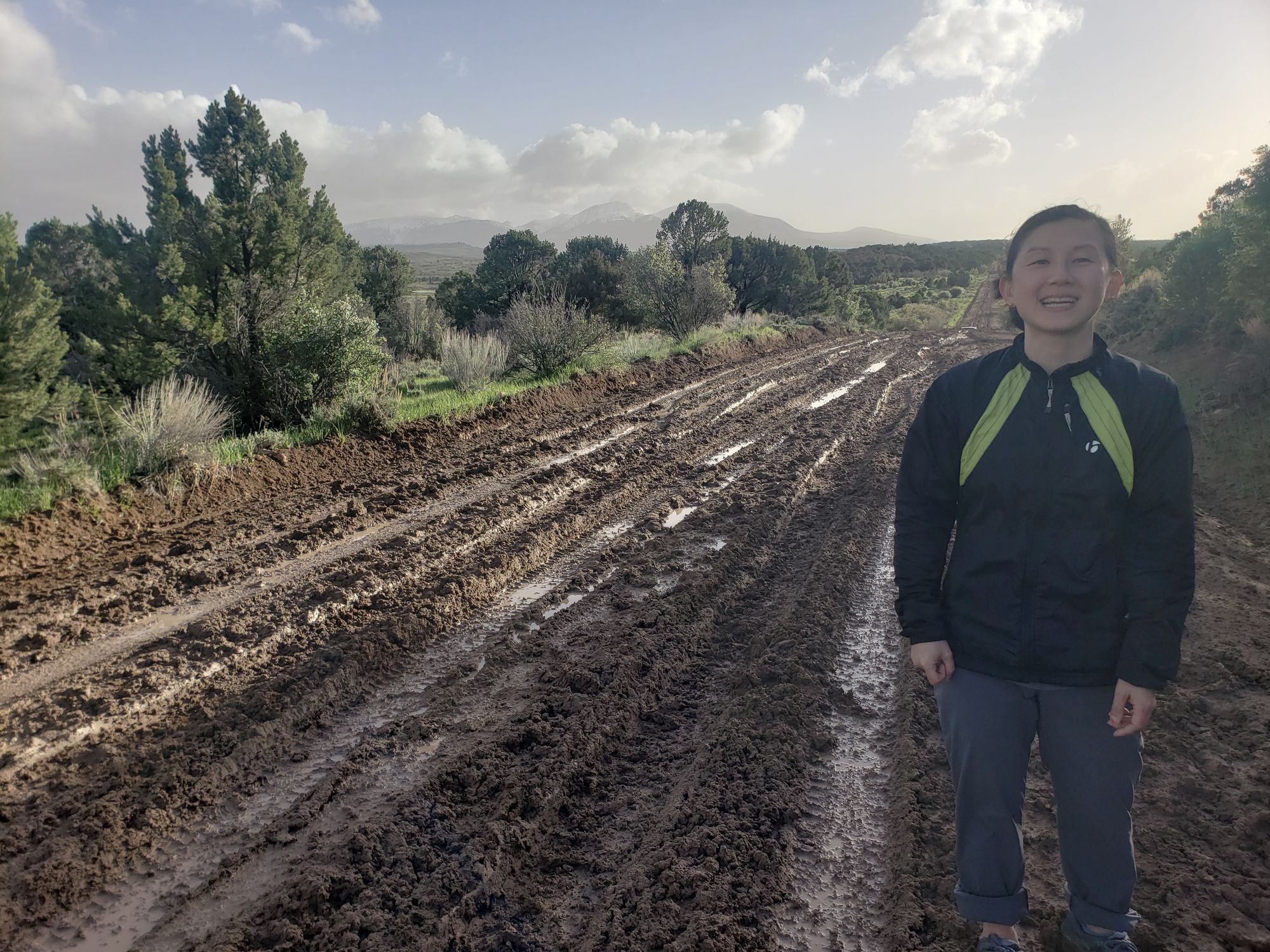
The mud was too deep and the hill was too steep to continue. We tried pushing and digging ourselves out for a few hours to no avail. Night set and we prepared to bed down in the car until morning.
Around 9pm we saw headlights, and spoke to a nice woman driving a 4 wheeler; we moved our car downhill and let her pass with the promise she’d tell someone we were stuck.
Around 10pm a gigantic truck pulls up behind us and a very heavily armed man, with 2 pistols, a rifle, and a flack jacket with at least 4 extended magazines jumps down. It was, thankfully, the county sheriff. Welcome to Utah!
The sheriff suggested that the cold temperature and wind had frozen the mud, so he and I pushed while Nancy floored it. The car made it up the hill and the sheriff (who turned out to be a very nice man) offered to follow us as far as the border with Colorado.
We resumed our nighttime mudslide drive. We passed two other cars pulled off and stuck in the mud. The road became better maintained when we passed the border, but we were back on a shear cliff-face running switchbacks under only the moonlight. We crawled forward.
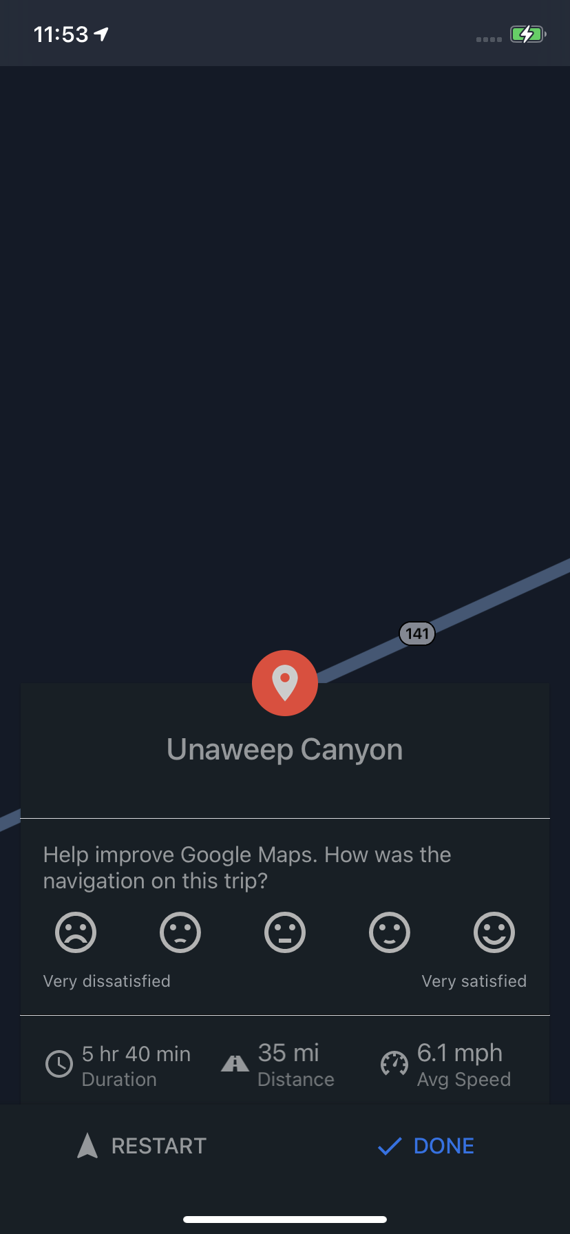
We hit a main road at about 11pm, and decided to continue on to Unaweep. We arrived at the camp-sight at 1am, built a small fire, drank two beers and ate our dinner – happy to be alive.
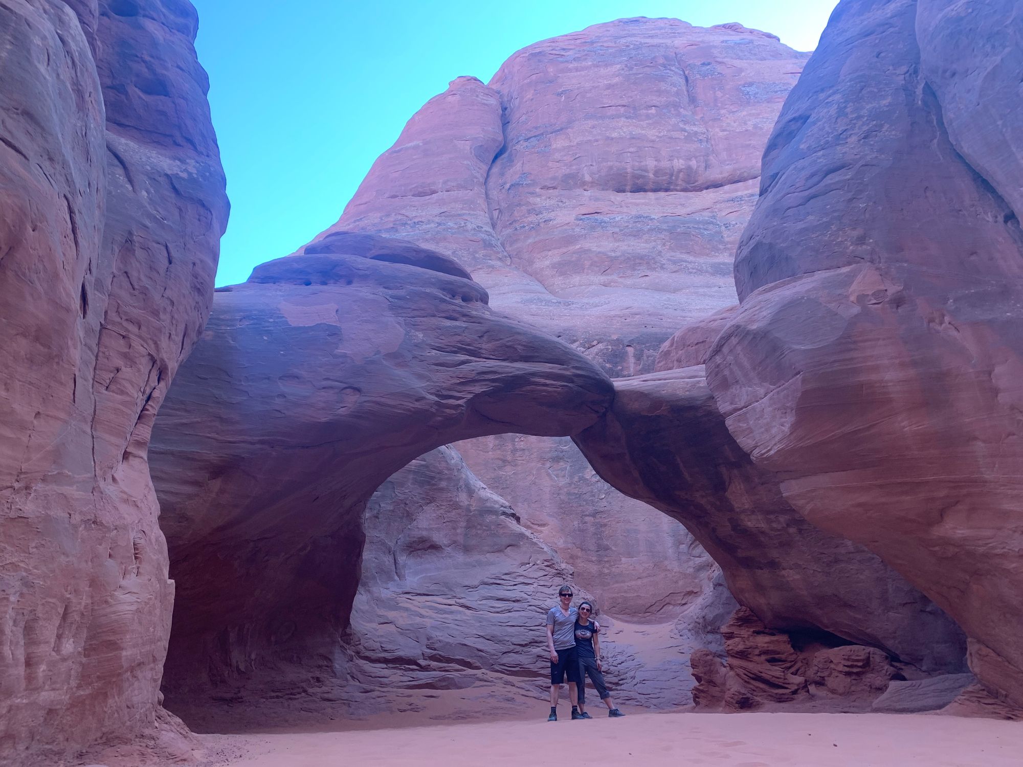
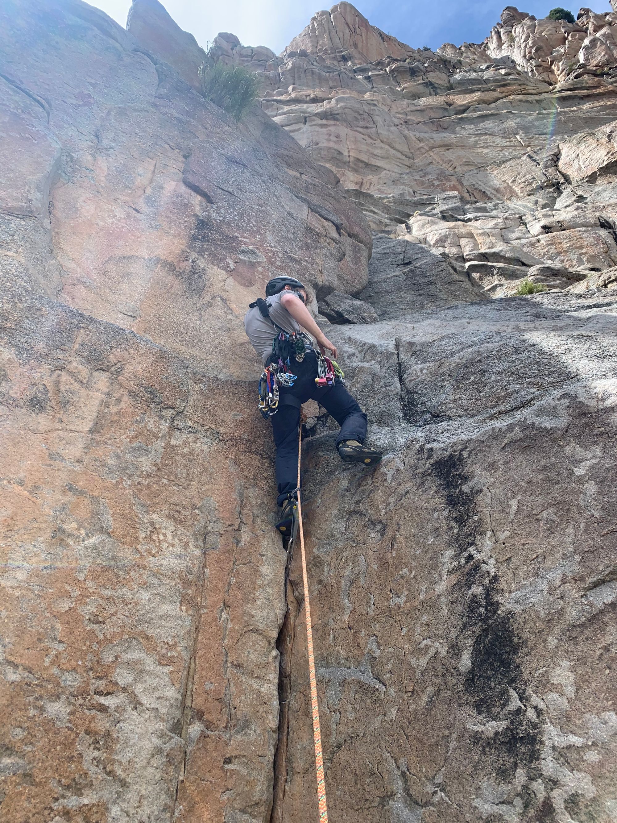
Luckily, the climbing was great.
The car is still recovering.